Weather warnings have been issued
The UK is bracing itself for a new Arctic blast, with a huge cloud of snow set to land early next week.
The Met Office has warned of ‘colder than average weather for the time of year’ with ‘a marked reduction in rainfall amounts following a wet start to January’.
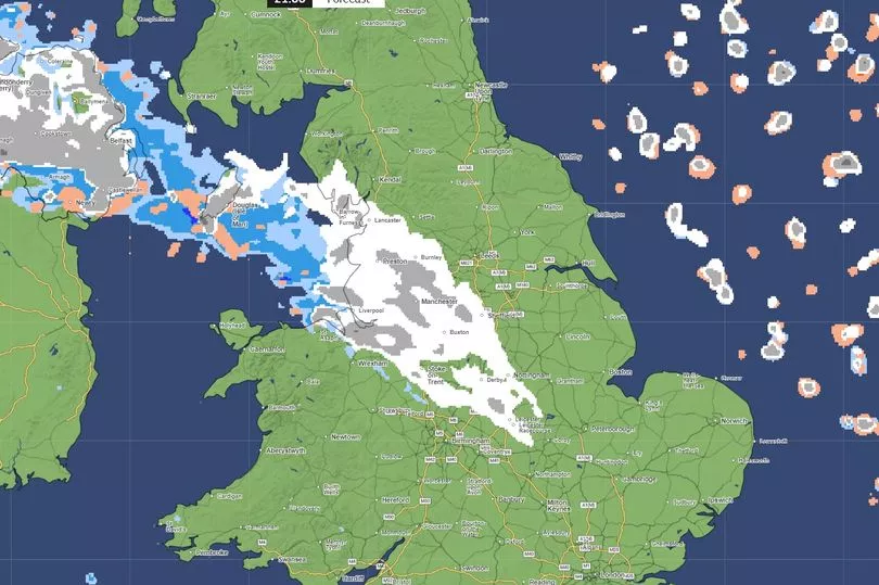
Maps show a huge cloud of snow set to hit the north of England on Monday 15 January, with an ‘Arctic influence’ falling over the whole island.
The cold temperatures will continue into Tuesday, with it not expected to warm up again until the middle of the week.
Met Office meteorologist Aidan McGivern said: “A cold front from the north towards the weekend will mark another change in the airmass for the UK, moving from something with a bit of an Atlantic influence to air that comes more directly from the Arctic.”
He continued: “We start with a northerly airflow and snow showers, especially near the coasts in the north. But there will also be brighter skies for some.
“Then, from the middle of next week, low pressure tries to move in from the South West, and the impact of this is still a bit uncertain at this range.
“Different models are saying different things in terms of the track of this low, but you have the ingredients for snow with cold air in place and additional moisture supplied from the Atlantic, which will bring rain, but on the boundary with the cold air, you could see some snow.”